Mapping
My day job is a GIS Analyst so I wanted to start collecting maps that I think are cool either in content or design.
- Marine Traffic - a site where you can monitor marine traffic in real time and get information like boat type, name, speed, etc.
- Animated Flyover Map of Index, WA - An animated map by Sarah Bell flying over Index, WA with 3D visualization of rock climbing routes and voiceover
- Falling Fruit - a worldwide collaborative map of urban foraging and free food locations
- Postcrossing Map - Pure html map designed by coffeeplant to track postcards received through postcrossing
- North Cascades Photo Map - my own photo map of outings in the North Cascades created with QGIS and Leaflet :)
- Amassalik Wooden Maps - Wooden carvings by native Greenlanders that functioned as maps of coastlines and islands
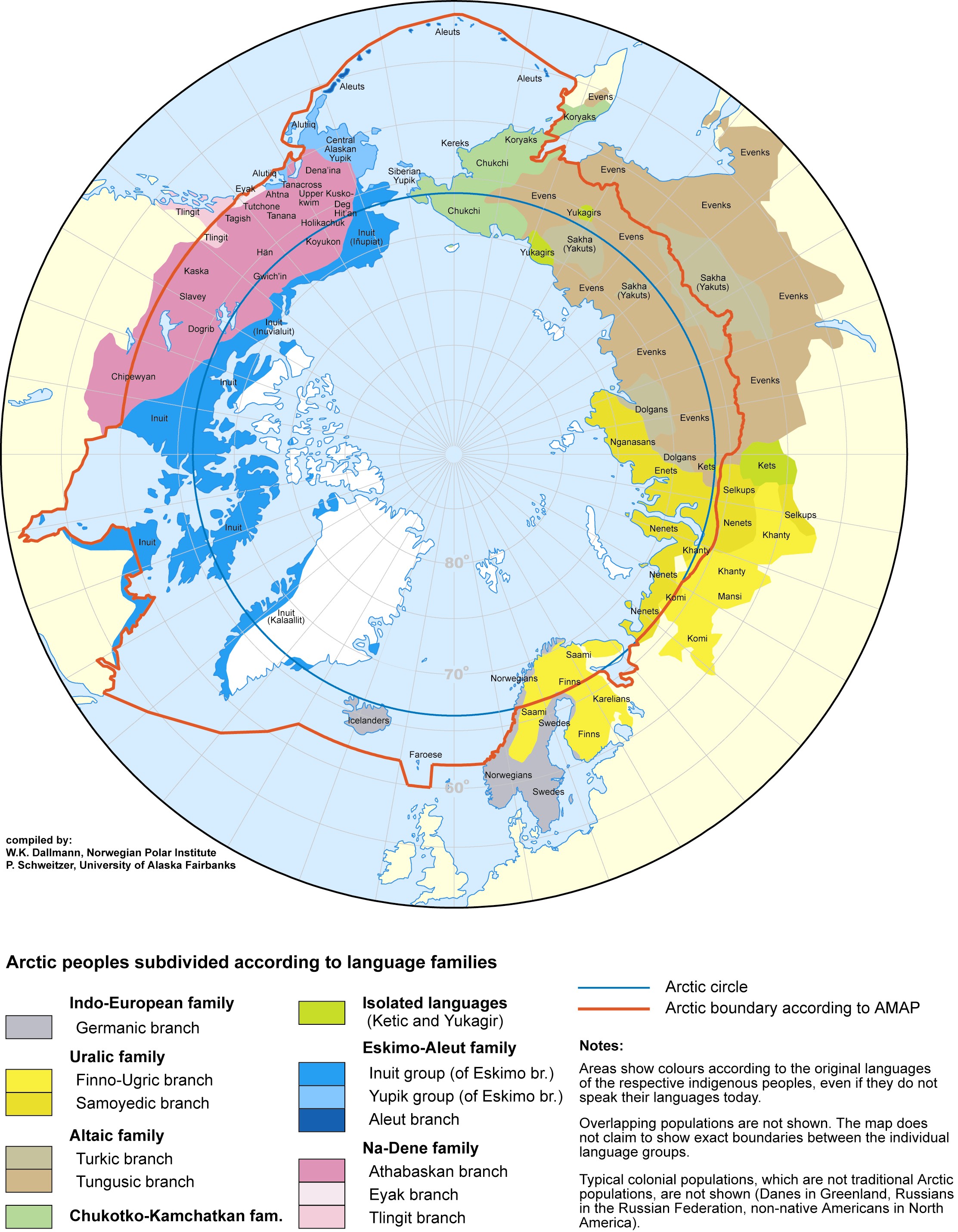
- Arctic Languages - a map centering the Arctic Ocean to show connections between indigenous peoples of the Arctic
 Home
Home